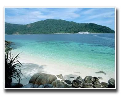
Koh Samet
Popular with foreign tourists and as a weekend getaway for residents of nearby Bangkok, most of the islandKoh Samet was named after the Samet Tree or the cajuput tree that grows everywhere on the island. It was declared Khao Lam Ya Samet Archipelago Maritime National Park in 1981. The park encompasses Had Mae Rumpueng-a beach on the coast of Rayong, Lam Ya Mountain and the Samet Archipelago that consists of Koh Samet, Koh Chan, Koh San Chalam, Koh Hin Khao, Koh Kang Kao, Koh Kudee, Koh Kruoy and Koh Plateen. An ecological tour can be conducted through three itineraries on Koh Samet, Koh Kudee and Lam Ya Mountain.
To reach the island, tourists must take a local fishing boat, from Ban Phea in Muang District of Rayong Province for about 30mins. Boats run back and forth around the clock with the minimum of seven passengers. There are direct routes to some beaches including Had Sai Kaew and Ao Wong Duan, from which one can walk to other beaches through a relatively primitive inland road network. Most of the beaches are located on the northern and eastern sides of this T-shaped island whereas only a few, that is, Ao Prao, Ao Kham and Ao Kiu Na Nai lie on the west. It is more convenient to reach Ao Prao by a direct ferry from Ban Phea.
The weather on the island is more comfortable than inland area. However, the rainy season runs from May to September with heavy rains, high surges and monsoons in May. Ideal activities here are sunbathing on the beach, making an inland excursion on foot or by chartered bus, and taking a boat trip around the island. Also recommended is making a trip to some nearby isles.
